|
|
|
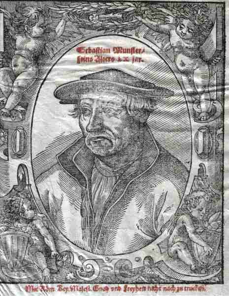
| Anonymous. 12.5 x15.5 cms. Portrait of Sebastian Munster, the cartographer. Creases. Price: $ 60.00 |
|
|
|
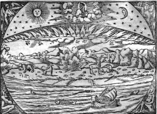
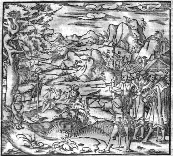
| Grundtlicher bercht von dem Meer / desselben natur und beschaffenheit. 15.7x11.5 cms. Page 1, Chapter 1 of Munster's 1576 page Atlas. I have included this woodcut in this, my navigation page, to emphasize the Europeans' thirst for knowledge and exploration in the sixteenth century, which was mixed with religion, myth, war between kingdoms, burnings at the stake and the fear of the Ottoman advance towards Rome. It depicts the Creator encircled by clouds , the sun, the moon and angels on either side; two devils at the bottom of the woodcut. The earth and the sea in the middle with animals, birds and fish; a sailing ship, too. Price: $ 90.00 | [ Untitled ]... Wilheim Thell. 14.4x13 cms. I have added this lovely woodcut next to the Creation scene as it brought back memories of my childhood and the fascinating legend of William Tell ( the Swiss national hero who was forced to shoot an apple from his son's head with a crossbow at a distance of eighty paces by the hated Austrian governor of Switzerland...an event that led to a revolt by the Swiss against Austrian oppression, or so the legend goes ). Alas I couldn't find a woodcut of Robin Hood and his bunch of merry men to include here; plenty of monsters though which I have allocated to the 'mythical' section below. Price: $ 90.00 |
|
THE WORLD The World Click*(2 ) Continents Click* (6) |
EUROPE Armenia Click* (1 page) Austria Click* (5) Baltic States Click* (1) Balkan States Click* (8) British Isles Click* (4) Cyprus Click* (5) Czech Rep. Click* (4) France Maps Click* (5) France City Plans Click* (29) Germany Maps Click* (21) Germany City Plans Click (43) Greece Click* (4) Hungary Click* (2) Holland & Belgium Click*(11) Italy Maps Click* (6) Italy City Plans Click* (26) Med. Islands Click* (10) Poland & Prussia Click* (6) Spain & Portugal Click* (6) Scandinavia Click * (3) Switzerland Click* (5) Switzerland City Plans Click* (16) Russia Click* (1) Turkey Click* (3) |
 Animals Click*
(7 pages)
Art & Architecture Click*
(7)
Arms & Weapons Click
Cartography Click*
(1)
Crafts & Trades Click
French Royalty Click*
(1)
Land Battles Click
Mythical Click*
Portraits Click
Animals Click*
(7 pages)
Art & Architecture Click*
(7)
Arms & Weapons Click
Cartography Click*
(1)
Crafts & Trades Click
French Royalty Click*
(1)
Land Battles Click
Mythical Click*
Portraits Click
|
|
AFRICA & THE MIDDLE EAST North Africa Click* (2) Egypt Click* (2) Arabia & Persia Click* Holy Land Click* (5) |
||
|
ASIA & THE AMERICAS South East Asia Click* Central Asia Click* (2) Americas Click* (3) |