Price: $ 950.00
|
|
|
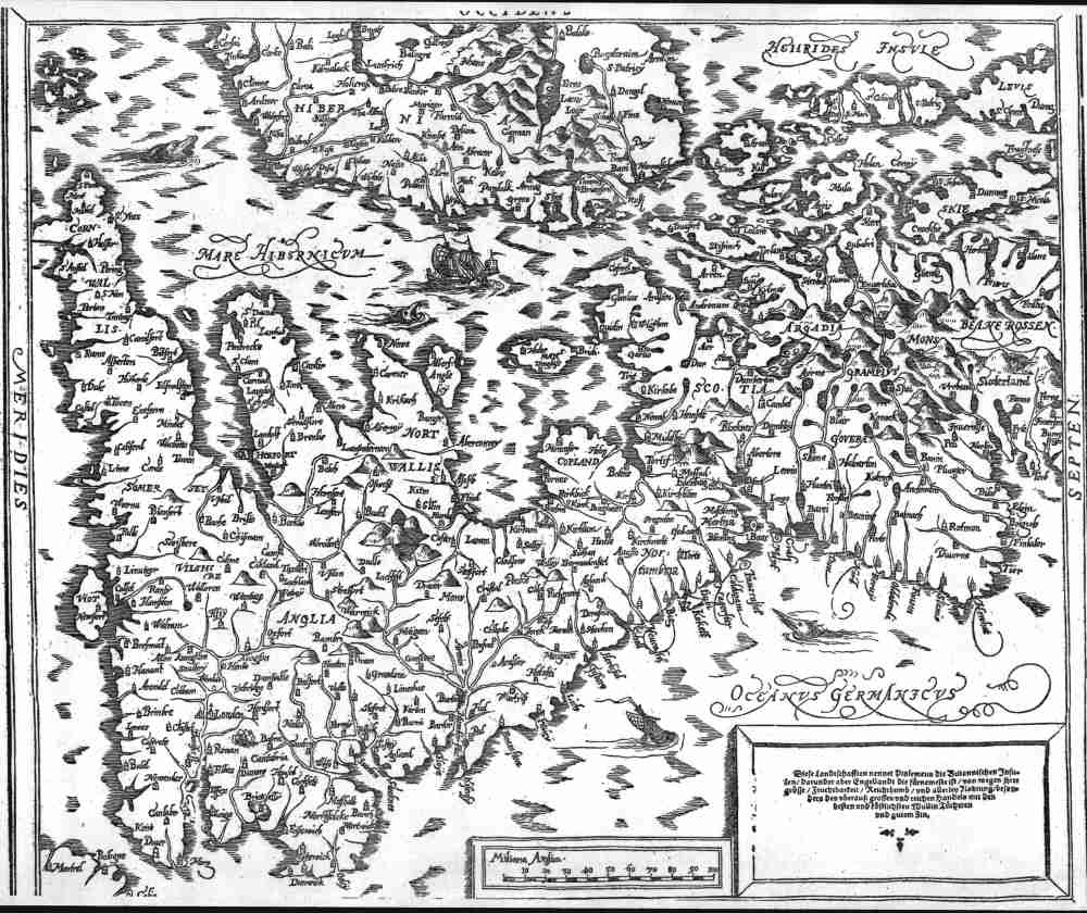
Engellandt / mit dem anstossenden Reich
Schottlandt / so bozeiten Albion und Britannia haben geheissen. 35.7x30.3
cms. Double page map of Britain and eastern Ireland. Title at top of
page with a simple cartouche at bottom right, plus a scale in ' Miliaria
Anglica'. Minor staining confined to margins and not affecting map area;
otherwise general condition of map is very fine. This is a much improved map of Britain, compared to Munster's
earlier Ptolemaic map of Britain, with hundreds of towns added in
Britain and eastern Ireland. The problem of fitting the Hebrides still
remained though, and they are again placed west of Scotland ( the
printers had most probably run out of printing space). The map is printed with the
west ( Ireland ) as north. Two sailing ships and three sea monsters. A
most pleasing and collectable early map of Britain. Ref # MBR2 Price: $ 950.00 |