|
|
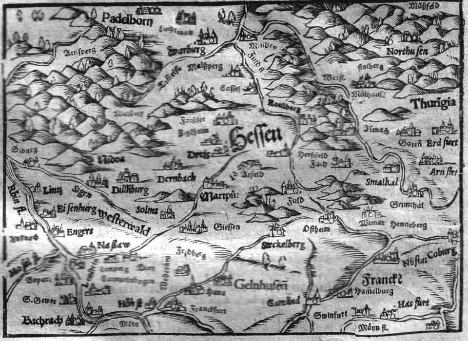
| Beschrebung der Hessenlandts. 15.7x11.5 cms. Ptolemaic map set in a page of text of the Hessen Region. Area covers the Thuringian Mounts and Coburg in the east, Frankfurt and the confluence of the rivers Rhine and Mosel in the south and Warberg in the north. Ref # MGER15 Price: $ 90.00 |