|
|
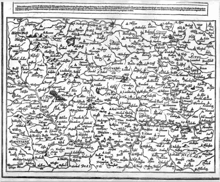
| Die Ander Tafel des Rheinstoms/ begreiffend die Pfaltz/ Westereich /zc. 36x30 cms. Double page map covering eastern France and south western Germany. Small tear and minor staining confined to the edges of the top margins and not affecting map image. Title above top margin. North is to the RIGHT of the map; Hessen ( south of the Moselle ) to the right( north ), following the course of the Rhine down to Heidelberg and Strasburg to the left (south). Ref # MGER2 Price: $ 350.00 |